
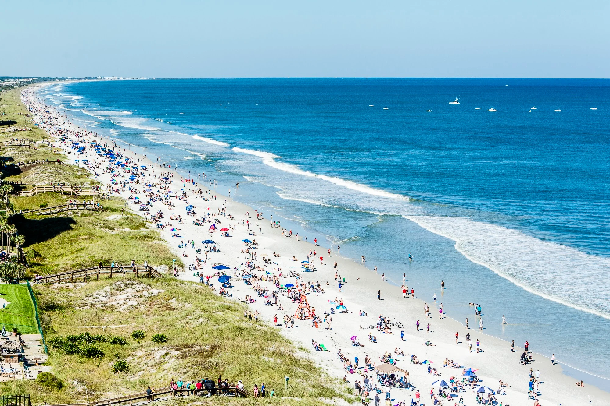
Florida Beaches Map: Gulf Coast, Atlantic Coast & Florida Keys
Florida’s beach destinations fall along the Gulf Coast, Atlantic Coast, and Florida Keys. Use the interactive map below to locate the main coastal towns and islands, then compare the regions in the beach index. Pensacola, Clearwater, Miami Beach, and Key West belong to very different trips, even though all four appear on the same state map.
Use the overview map, regional index, and official access finder below to narrow the search. This guide focuses on location and public access; our Florida sand beaches guide compares destinations in more detail.
Table of Contents
- Quick answer
- Florida overview map
- Regional beach index
- Northwest Florida
- Forgotten Coast and Big Bend
- Central and Southwest Gulf Coast
- Florida Keys
- Atlantic Coast
- Find public access and parking
- Plan a regional trip
- FAQs
Quick Answer: Where Are Florida’s Main Beach Regions?
Florida’s Gulf-facing beaches run across the Panhandle and down the western peninsula; the Atlantic beaches follow the eastern peninsula from Amelia Island toward Miami. The Florida Keys extend southwest from the mainland. For planning, separate the Panhandle, Tampa Bay area, Southwest Florida, Keys, and northern, central, and southeastern Atlantic coast.
Start with a region, then identify a specific public beach entrance. A city name or an island label is not the same thing as a parking lot with legal beach access.
Florida Beaches Overview Map
Zoom and pan this geographic map to see the two coasts, barrier islands, coastal towns, and connecting roads. It is an orientation map, not a live directory of open beach entrances. Use the official access finder below for individual access sites and facilities.
Map data © OpenStreetMap contributors, available under the Open Database License.
Florida Beach Regions at a Glance
These are practical travel groupings. Tourism names such as Emerald Coast, Nature Coast, and Treasure Coast can have overlapping or differently described boundaries.
| Region | Where to look on the map | Beach areas to locate | Planning distinction |
|---|---|---|---|
| Western Panhandle | Near the Alabama border, east toward Santa Rosa County | Perdido Key, Pensacola Beach, Navarre Beach | Barrier-island beach trips |
| Emerald Coast and eastern Panhandle resorts | Fort Walton Beach through Destin, South Walton, and Panama City Beach | Okaloosa Island, Henderson Beach, Grayton Beach | Choose one local base rather than assuming all beaches are adjacent |
| Forgotten Coast | Farther east around Gulf and Franklin counties | Cape San Blas, Mexico Beach, St. George Island | More emphasis on smaller communities and natural shorelines |
| Big Bend and Nature Coast | The curve between the Panhandle and west-central peninsula | Cedar Key area and localized public coastal parks | Not a continuous strip of broad sand beaches |
| Tampa Bay and Central Gulf | Pinellas County and the coast south toward Sarasota | Clearwater Beach, St. Pete Beach, Anna Maria Island, Lido Key, Siesta Key | Bridges and island access affect local driving |
| Southwest Gulf | Charlotte, Lee, and Collier county coastlines | Englewood area, Sanibel, Fort Myers Beach, Naples, Marco Island | Compare mainland, bridge-access, and boat-access destinations |
| Florida Keys | The island chain southwest of Florida City | Key Largo, Bahia Honda, Key West | Select an actual beach; coastline does not always mean sand |
| Northeast Atlantic | Georgia border south through St. Augustine and Flagler | Amelia Island, Jacksonville Beach, St. Augustine Beach, Flagler Beach | Historic towns and ocean beaches can be separate stops |
| Central Atlantic | Volusia and Brevard counties, continuing toward the Treasure Coast | Daytona Beach, New Smyrna Beach, Cocoa Beach, Vero Beach | Pick the beach access, not just the nearest inland city |
| Southeast Atlantic | Palm Beach County south through Broward and Miami-Dade | Palm Beach, Fort Lauderdale, Hollywood, Miami Beach | Urban waterfronts with different parking arrangements |
Northwest Florida: Follow the Coast From West to East
Locate Perdido Key first, close to Alabama. Moving east, find Pensacola Beach and Navarre Beach, then the Fort Walton Beach and Destin area. South Walton and Panama City Beach continue the coastal sequence farther east.
The useful distinction here is between the mainland communities and the beach islands or shoreline parks. A hotel in a city carrying a familiar beach name may still require a drive over a bridge to reach the sand. For South Walton park visits, compare the beach access, lakes, and trails in our Grayton Beach State Park guide and Topsail Hill Preserve guide.
For an individual stop, compare our Navarre Beach guide with Henderson Beach State Park in Destin. These give more practical detail once you have narrowed your map search.
The broader Florida DEP Panhandle guide connects to coastal county information. Use local park pages for current opening arrangements rather than assuming every map marker is open.
Forgotten Coast, Big Bend, and Nature Coast: Read the Shoreline Carefully
East of the main Panhandle resort areas, the coast curves around toward the western peninsula. Cape San Blas and St. George Island are useful landmarks when you want a sandy barrier-island destination in the Forgotten Coast.
Farther around the bend, marshes, estuaries, and mangroves become an important part of the coastal picture. This is why a waterfront accommodation or a road ending at the coast may not deliver the broad swimming beach you imagined.
For Cape San Blas and nearby access planning, the Gulf County beach-access maps are more useful than a statewide tourism map alone. Farther south, our Green Key Beach guide explains a specific small coastal park near New Port Richey; it should not be confused with the larger barrier-island beaches around Clearwater.
Central and Southwest Gulf Coast: Choose Your Island and Entrance
On the map west of Tampa, locate the Pinellas County shoreline, including Clearwater Beach and St. Pete Beach. Then move south to Anna Maria Island and the Sarasota barrier islands, including Lido Key and Siesta Key.
Continue toward the Englewood area, Sanibel, Fort Myers Beach, Naples, and Marco Island. These names cover a long stretch of coast. Pick a smaller area for a short stay instead of treating them as neighboring stops.
For white-sand comparisons, use our white sand beaches in Florida guide. If you are examining the Englewood and Manasota Key area, the Stump Pass Beach State Park guide provides a specific park destination.
The map can also reveal a practical trap: two beaches that look close across water may require a long drive via bridges or mainland roads. Use driving directions between the actual entrances before planning lunch at one and an afternoon at another.
Florida Keys: Beach Locations Are More Important Than Coastline Length
The Keys run southwest from the mainland, with Key Largo toward the upper end and Key West near the far end of the road-accessible chain. They should not be treated as one interchangeable beach destination.
Bahia Honda State Park is a useful beach landmark in the Lower Keys. It has distinct shoreline areas, including Calusa Beach on the bay-facing side. The Bahia Honda State Park website provides its park map and current visitor information.
When choosing a Keys stay, separate the beach you can visit from the water activity you intend to book. A waterfront room, marina, or reef excursion departure point does not necessarily include a broad sandy beach. Confirm the actual access arrangement before booking around a beach assumption.
Atlantic Coast: Follow the Map From North to South
Northeast Florida
Begin around Amelia Island, then follow the coast south past Jacksonville’s beach communities toward St. Augustine and Flagler Beach. City-center pins can sit inland from the ocean. Put the named beach park into navigation when the sand is your destination.
Central Atlantic and Treasure Coast
Daytona Beach and New Smyrna Beach are in Volusia County. Cocoa Beach is farther south in Brevard County. Vero Beach, the Fort Pierce area, and the Stuart area continue the sequence toward southeastern Florida.
For a stay based inland, compare your road connection and the final bridge or causeway, rather than selecting a beach by a straight line across the map.
Southeast Florida
Follow Palm Beach County south through Fort Lauderdale and Hollywood toward Miami Beach. These urban beaches have separate municipal access and parking systems. A beach name alone does not establish whether parking is free, whether pets are allowed, or whether lifeguards are present.
The Florida DEP Atlantic Coast guide links its coastal counties in north-to-south order, making it a useful next step after this overview.
How to Find Public Beach Access, Parking, and Facilities
Open the official Florida Coastal Access Guide and select its interactive access map. The directory includes information such as parking, accessibility, facilities, picnic areas, and fees for individual access points.
- Find your coastal region. Zoom to the town or island where you plan to stay.
- Select a public access site. Distinguish an actual entrance from a general beach label.
- Read the facilities information. Decide whether your group needs restrooms, an accessible route, showers, or picnic space.
- Confirm the local operator’s current notice. Storm damage, maintenance, or capacity restrictions can affect access even when a map marker remains visible.
- Save the exact parking destination. Keep a second legal entrance in mind if the first lot is full.
A mapped access point does not mean every nearby property is open to visitors. Use designated entrances and follow posted boundaries. For mobility planning, confirm both the route to the shoreline and the equipment or assistance you need; an accessible parking space alone does not describe the whole visit.
Turn the Map Into a Practical Beach Trip
For a short visit, choose one region and a small number of nearby beaches. A Panhandle itinerary, Sarasota-area stay, Northeast Florida trip, and Keys road trip each work better as their own plan than as a rushed statewide checklist.
Compare the location of your accommodation with the public entrance you will use. Being near the coast can still mean bridge traffic, parking queues, or a walk with equipment. A less famous access point with the facilities you need may suit your day better than a distant headline beach.
Before leaving, look at local beach notices and weather conditions as well as the map. Geography helps you choose where to go; it cannot tell you whether the water is suitable that day or whether a particular facility is temporarily unavailable.
Florida Beaches Map FAQs
Is Siesta Key part of the Florida Keys?
No. Siesta Key is a Gulf Coast barrier island near Sarasota. The Florida Keys are the island chain extending southwest from the southern mainland.
Is Miami Beach the same place as Miami?
No. Miami Beach is a separate coastal city on a barrier island across Biscayne Bay from Miami. Use the beach’s exact address when planning your arrival.
Does this map show live parking availability?
No. The overview map shows geography. The official access guide helps identify facilities, while local operators provide current parking and access information where available.
Final Thoughts
Choose the coastline first, the town or island second, and the public entrance third. That sequence makes a Florida beach trip much easier to plan and avoids confusing a coastal location with a beach you can actually reach and use.
3 Comments